Tennessee Landforms -- waterfalls| WGS84 |
| 35.446300 | -84.092660 |
| 35° 26.778'N | 84° 5.56'W |
| 35° 26' 46.7"N | 84° 5' 33.6"W |
| 16S 763888E 3926423N |
| convert to NAD27 |
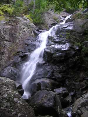
Jake Best Creek Cascade 100'
Waypoint: MOF022 35.446300,-84.092660
County: Monroe landforms of Monroe county
Locale: Cherokee National Forest
popup list of
nearby landforms (mileage, bearing)
MAPS
Select one of the following maps to display this waypoint (WGS84).
GPS
Remarks:
Ref: Tim Watson
off-trail
several small falls above the main cascade
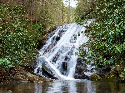 an upper falls, courtesy Michael Shannon
Tennessee landforms
home
arches
waterfalls
rocks
peaks
balds
sinks
lakes
regions
county
GSMNP landforms (TN/NC)
BSF landforms (TN/KY)
or nearby
lookout towers
Chuck Sutherland's www.tnlandforms.com the future (2024)
 ©
Tom Dunigan
©
Tom Dunigan