Tennessee Landforms -- waterfalls| WGS84 |
| 35.435000 | -84.039700 |
| 35° 26.1'N | 84° 2.382'W |
| 35° 26' 6"N | 84° 2' 22.9"W |
| 16S 768734E 3925312N |
| convert to NAD27 |
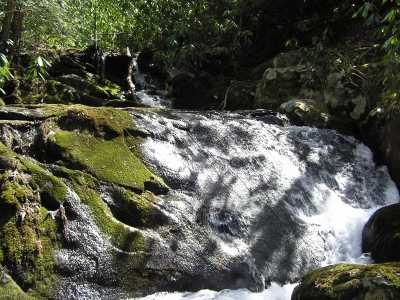
Crowder Branch Cascade
Waypoint: MOF010 35.435000,-84.039700
County: Monroe landforms of Monroe county
Locale: Cherokee National Forest
popup list of
nearby landforms (mileage, bearing)
MAPS
Select one of the following maps to display this waypoint (WGS84).
GPS
Remarks:
CNF trail 84. also see
Citico Creek Wilderness
Tennessee landforms
home
arches
waterfalls
rocks
peaks
balds
sinks
lakes
regions
county
GSMNP landforms (TN/NC)
BSF landforms (TN/KY)
or nearby
lookout towers
Chuck Sutherland's www.tnlandforms.com the future (2024)
 ©
Tom Dunigan
©
Tom Dunigan