Tennessee Landforms -- waterfalls| WGS84 |
| 35.354800 | -84.064400 |
| 35° 21.288'N | 84° 3.864'W |
| 35° 21' 17.3"N | 84° 3' 51.8"W |
| 16S 766756E 3916346N |
| convert to NAD27 |
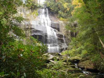
Falls Branch Falls 55'
Waypoint: MOF008 35.354800,-84.064400
County: Monroe landforms of Monroe county
Locale: Cherokee National Forest
popup list of
nearby landforms (mileage, bearing)
MAPS
Select one of the following maps to display this waypoint (WGS84).
GPS
Remarks:
'bout 1.5 miles from the Cherohala Skyway on CNF trail 87.
Tennessee landforms
home
arches
waterfalls
rocks
peaks
balds
sinks
lakes
regions
county
GSMNP landforms (TN/NC)
BSF landforms (TN/KY)
or nearby
lookout towers
Chuck Sutherland's www.tnlandforms.com the future (2024)
 ©
Tom Dunigan
©
Tom Dunigan