Tennessee Landforms -- waterfalls| WGS84 |
| 35.364380 | -84.053630 |
| 35° 21.863'N | 84° 3.218'W |
| 35° 21' 51.8"N | 84° 3' 13.1"W |
| 16S 767703E 3917438N |
| convert to NAD27 |
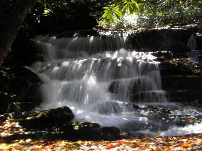
S. Fork Citico Cascades
Waypoint: MOF005 35.364380,-84.053630
County: Monroe landforms of Monroe county
Locale: Cherokee National Forest
popup list of
nearby landforms (mileage, bearing)
MAPS
Select one of the following maps to display this waypoint (WGS84).
GPS
Remarks:
CNF trail 105 in
Citico Creek Wilderness
Waypoint is for upper falls, numerous 8 to 10' falls and cascades in
the stretch of creek 0.5 miles downstream.
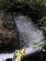

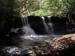 upper falls
Tennessee landforms
home
arches
waterfalls
rocks
peaks
balds
sinks
lakes
regions
county
GSMNP landforms (TN/NC)
BSF landforms (TN/KY)
or nearby
lookout towers
Chuck Sutherland's www.tnlandforms.com the future (2024)
 ©
Tom Dunigan
©
Tom Dunigan