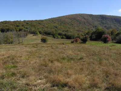
 View of Haw Knob across Whigg Meadow.
| WGS84 | |
| 35.309800 | -84.038200 |
| 35° 18.588'N | 84° 2.292'W |
| 35° 18' 35.3"N | 84° 2' 17.5"W |
| 16S 769287E 3911425N | |
| convert to NAD27 | |
MAPS
Select one of the following maps to display this waypoint (WGS84).
GPS
Remarks:
Whigg Meadow is along the Benton MacKaye Trail. There is a pond just west of the bald at the headwaters of Roaring Branch, here
View of Haw Knob across Whigg Meadow.
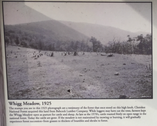 1925 photo