Tennessee Landforms -- arches and natural bridges| WGS84 |
| 35.375290 | -84.325980 |
| 35° 22.517'N | 84° 19.559'W |
| 35° 22' 31"N | 84° 19' 33.5"W |
| 16S 742919E 3917946N |
| convert to NAD27 |
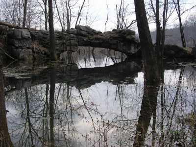
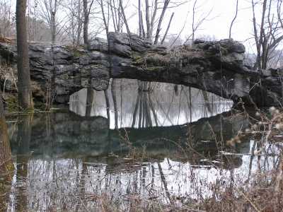
Shortfoots Natural Bridge 15x4
Waypoint: MOA002 35.375290,-84.325980
County: Monroe landforms of Monroe county
NABSQNO 16S-742919-3917946
popup list of
nearby landforms (mileage, bearing)
MAPS
Select one of the following maps to display this waypoint (WGS84).
GPS
Remarks:
Reference: Keith Garnes
Limestone natural bridge over sinkhole pond.
Sinkhole probably drains via spring to NE.
Tennessee landforms
home
arches
waterfalls
rocks
peaks
balds
sinks
lakes
regions
county
GSMNP landforms (TN/NC)
BSF landforms (TN/KY)
or nearby
lookout towers
Chuck Sutherland's www.tnlandforms.com the future (2024)
 ©
Tom Dunigan
©
Tom Dunigan