Tennessee Landforms -- arches and natural bridges| WGS84 |
| 35.086960 | -85.412970 |
| 35° 5.218'N | 85° 24.778'W |
| 35° 5' 13.1"N | 85° 24' 46.7"W |
| 16S 644672E 3883839N |
| convert to NAD27 |
CT Natural Bridge 70x30
Waypoint: MIA001 35.086960,-85.412970
County: Marion landforms of Marion county
Locale: Cumberland Trail
NABSQNO 16S-644672-3883839
popup list of
nearby landforms (mileage, bearing)
MAPS
Select one of the following maps to display this waypoint (WGS84).
GPS
Remarks:
References: JNAD:TENN-49,Cumberland Tr. map
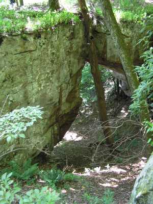
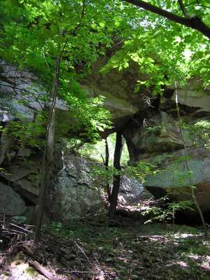
The Cumberland Trail passes over this natural bridge in Prentice Cooper WMA.
Tennessee landforms
home
arches
waterfalls
rocks
peaks
balds
sinks
lakes
regions
county
GSMNP landforms (TN/NC)
BSF landforms (TN/KY)
or nearby
lookout towers
Chuck Sutherland's www.tnlandforms.com the future (2024)
 ©
Tom Dunigan
©
Tom Dunigan