Tennessee Landforms -- rock formations| WGS84 |
| 36.120920 | -84.811120 |
| 36° 7.255'N | 84° 48.667'W |
| 36° 7' 15.3"N | 84° 48' 40"W |
| 16S 696992E 3999579N |
| convert to NAD27 |
Hegler Chimney 30'
Waypoint: MGR003 36.120920,-84.811120
County: Morgan landforms of Morgan county
Locale: Obed Wild & Scenic River
popup list of
nearby landforms (mileage, bearing)
MAPS
Select one of the following maps to display this waypoint (WGS84).
GPS
Remarks:
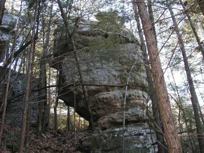
There are arches nearby.
Tennessee landforms
home
arches
waterfalls
rocks
peaks
balds
sinks
lakes
regions
county
GSMNP landforms (TN/NC)
BSF landforms (TN/KY)
or nearby
lookout towers
Chuck Sutherland's www.tnlandforms.com the future (2024)
 ©
Tom Dunigan
©
Tom Dunigan