Tennessee Landforms -- waterfalls| WGS84 |
| 36.060681 | -84.635786 |
| 36° 3.641'N | 84° 38.147'W |
| 36° 3' 38.5"N | 84° 38' 8.8"W |
| 16S 712936E 3993266N |
| convert to NAD27 |
Railroad Falls 20'
Waypoint: MGF029 36.060681,-84.635786
County: Morgan landforms of Morgan county
popup list of
nearby landforms (mileage, bearing)
MAPS
Select one of the following maps to display this waypoint (WGS84).
GPS
Remarks:
Reference and photo: Chris Oliver
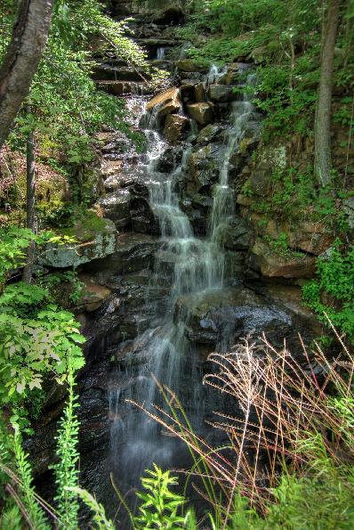
Dana reports 12' upper falls at 36.061682,-84.635624
Tennessee landforms
home
arches
waterfalls
rocks
peaks
balds
sinks
lakes
regions
county
GSMNP landforms (TN/NC)
BSF landforms (TN/KY)
or nearby
lookout towers
Chuck Sutherland's www.tnlandforms.com the future (2024)
 ©
Tom Dunigan
©
Tom Dunigan