Tennessee Landforms -- waterfalls| WGS84 |
| 35.951670 | -84.580560 |
| 35° 57.1'N | 84° 34.834'W |
| 35° 57' 6"N | 84° 34' 50"W |
| 16S 718212E 3981294N |
| convert to NAD27 |
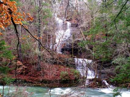
Clifty Creek Falls 60'
Waypoint: MGF021 35.951670,-84.580560
County: Morgan landforms of Morgan county
popup list of
nearby landforms (mileage, bearing)
MAPS
Select one of the following maps to display this waypoint (WGS84).
GPS
Remarks:
Reference and photo: Chris Oliver
two more wet-weather falls to the west at
35.951739,-84.584119
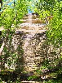 Chris's photo
and at
35.948939,-84.585214 Chris's
photo
Tennessee landforms
home
arches
waterfalls
rocks
peaks
balds
sinks
lakes
regions
county
GSMNP landforms (TN/NC)
BSF landforms (TN/KY)
or nearby
lookout towers
Chuck Sutherland's www.tnlandforms.com the future (2024)
 ©
Tom Dunigan
©
Tom Dunigan