| WGS84 | |
| 36.055688 | -84.440292 |
| 36° 3.341'N | 84° 26.418'W |
| 36° 3' 20.5"N | 84° 26' 25.1"W |
| 16S 730562E 3993158N | |
| convert to NAD27 | |
MAPS
Select one of the following maps to display this waypoint (WGS84).
GPS
Remarks:
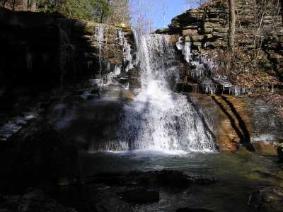
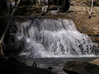
The waypoint is for the upper falls just below where TN62 crosses the creek. Plumb's tick mark is for the 10' lower falls 500 yds downstream, though his picture is the upper falls. Small feeder falls can be found along the railroad bed on the west wall of the canyon (Stevens Switch spur). Pics are the upper and lower falls.