Tennessee Landforms -- waterfalls| WGS84 |
| 36.100036 | -84.718560 |
| 36° 6.002'N | 84° 43.114'W |
| 36° 6' 0.1"N | 84° 43' 6.8"W |
| 16S 705377E 3997454N |
| convert to NAD27 |
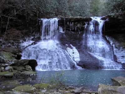
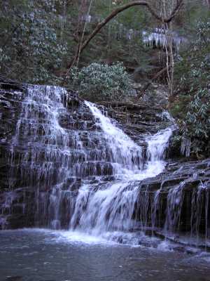
Melton Mill Br. Falls 30'
Waypoint: MGF007 36.100036,-84.718560
County: Morgan landforms of Morgan county
Locale: OWSR
popup list of
nearby landforms (mileage, bearing)
MAPS
Select one of the following maps to display this waypoint (WGS84).
GPS
Remarks:
There is a 13' Lower Falls downstream. Both falls have manways leading
from the bluff trail. Pics are upper and lower falls.
more photos: lower and
upper
Tennessee landforms
home
arches
waterfalls
rocks
peaks
balds
sinks
lakes
regions
county
GSMNP landforms (TN/NC)
BSF landforms (TN/KY)
or nearby
lookout towers
Chuck Sutherland's www.tnlandforms.com the future (2024)
 ©
Tom Dunigan
©
Tom Dunigan