Tennessee Landforms -- waterfalls| WGS84 |
| 36.098140 | -84.709960 |
| 36° 5.888'N | 84° 42.598'W |
| 36° 5' 53.3"N | 84° 42' 35.9"W |
| 16S 706157E 3997262N |
| convert to NAD27 |
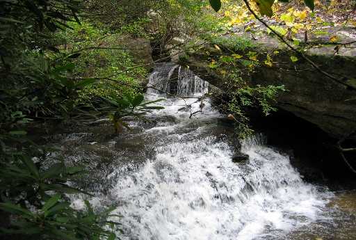
Jacks Rock Falls 8'
Waypoint: MGF005 36.098140,-84.709960
County: Morgan landforms of Morgan county
Locale: Obed Wild & Scenic River
popup list of
nearby landforms (mileage, bearing)
MAPS
Select one of the following maps to display this waypoint (WGS84).
GPS
Remarks:
white-water drop, Chris Oliver photo
Tennessee landforms
home
arches
waterfalls
rocks
peaks
balds
sinks
lakes
regions
county
GSMNP landforms (TN/NC)
BSF landforms (TN/KY)
or nearby
lookout towers
Chuck Sutherland's www.tnlandforms.com the future (2024)
 ©
Tom Dunigan
©
Tom Dunigan