Tennessee Landforms -- arches and natural bridges| WGS84 |
| 36.119780 | -84.810820 |
| 36° 7.187'N | 84° 48.649'W |
| 36° 7' 11.2"N | 84° 48' 38.9"W |
| 16S 697022E 3999453N |
| convert to NAD27 |
Hegler Arches 50x50
Waypoint: MGA004 36.119780,-84.810820
County: Morgan landforms of Morgan county
Locale: Obed Wild & Scenic River
NABSQNO 16S-697022-3999453
popup list of
nearby landforms (mileage, bearing)
MAPS
Select one of the following maps to display this waypoint (WGS84).
GPS
Remarks:
The (former) Hegler Ford road passed over this massive arch.
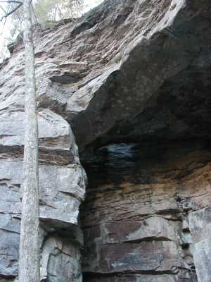
Hegler Arch
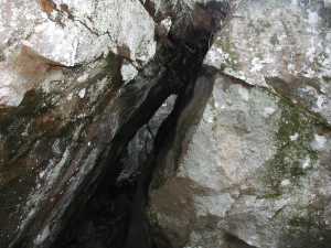
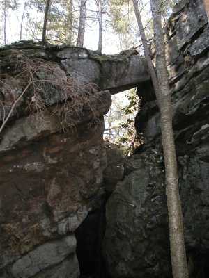
A little further north there are some gravity arches and a chimney.
This section of the creek is a popular overnight canoe trip.
Tennessee landforms
home
arches
waterfalls
rocks
peaks
balds
sinks
lakes
regions
county
GSMNP landforms (TN/NC)
BSF landforms (TN/KY)
or nearby
lookout towers
Chuck Sutherland's www.tnlandforms.com the future (2024)
 ©
Tom Dunigan
©
Tom Dunigan