Tennessee Landforms -- waterfalls| WGS84 |
| 36.518236 | -86.050659 |
| 36° 31.094'N | 86° 3.04'W |
| 36° 31' 5.6"N | 86° 3' 2.4"W |
| 16S 585000E 4041850N |
| convert to NAD27 |
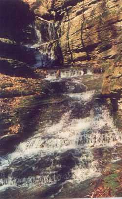
Winding Stair Cascade 100'
Waypoint: MAF001 36.518236,-86.050659
County: Macon landforms of Macon county
popup list of
nearby landforms (mileage, bearing)
MAPS
Select one of the following maps to display this waypoint (WGS84).
GPS
Remarks:
Reference & photo: Vic Fife
Chuck Sutherland photo
Tennessee landforms
home
arches
waterfalls
rocks
peaks
balds
sinks
lakes
regions
county
GSMNP landforms (TN/NC)
BSF landforms (TN/KY)
or nearby
lookout towers
Chuck Sutherland's www.tnlandforms.com the future (2024)
 ©
Tom Dunigan
©
Tom Dunigan