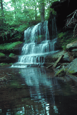 Photo by Gregory Plumb, Author of
Waterfalls of Tennessee
Photo by Gregory Plumb, Author of
Waterfalls of Tennessee
| WGS84 | |
| 35.139440 | -87.240560 |
| 35° 8.366'N | 87° 14.434'W |
| 35° 8' 22"N | 87° 14' 26"W |
| 16S 478086E 3888533N | |
| convert to NAD27 | |
MAPS
Select one of the following maps to display this waypoint (WGS84).
GPS
Remarks:
Robert Edgar's photo
Photo by Gregory Plumb, Author of
Waterfalls of Tennessee