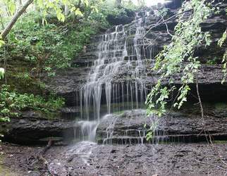 Photo by Gregory Plumb, Author of
Waterfalls of Tennessee
Photo by Gregory Plumb, Author of
Waterfalls of Tennessee
| WGS84 | |
| 35.494800 | -87.352600 |
| 35° 29.688'N | 87° 21.156'W |
| 35° 29' 41.3"N | 87° 21' 9.4"W |
| 16S 468019E 3927974N | |
| convert to NAD27 | |
MAPS
Select one of the following maps to display this waypoint (WGS84).
GPS
Remarks:
Wet-weather falls that is part of Swan Trust Conservancy see picture
Photo by Gregory Plumb, Author of
Waterfalls of Tennessee