 Photo by Gregory Plumb, Author of
Waterfalls of Tennessee
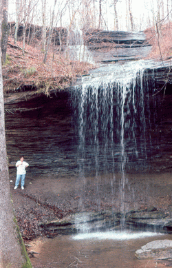
Photo by Gregory Plumb, Author of
Waterfalls of Tennessee
| WGS84 | |
| 35.583900 | -87.428200 |
| 35° 35.034'N | 87° 25.692'W |
| 35° 35' 2"N | 87° 25' 41.5"W |
| 16S 461206E 3937883N | |
| convert to NAD27 | |
MAPS
Select one of the following maps to display this waypoint (WGS84).
GPS
Remarks:
milepost 391.9 on Natchez Trace, and here is NPS info and map
Photo by Gregory Plumb, Author of
Waterfalls of Tennessee