Tennessee Landforms -- rock formations| WGS84 |
| 36.601458 | -84.006590 |
| 36° 36.087'N | 84° 0.395'W |
| 36° 36' 5.2"N | 84° 0' 23.7"W |
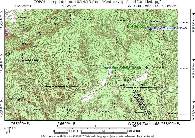
| 16S 767761E 4054835N |
| convert to NAD27 |
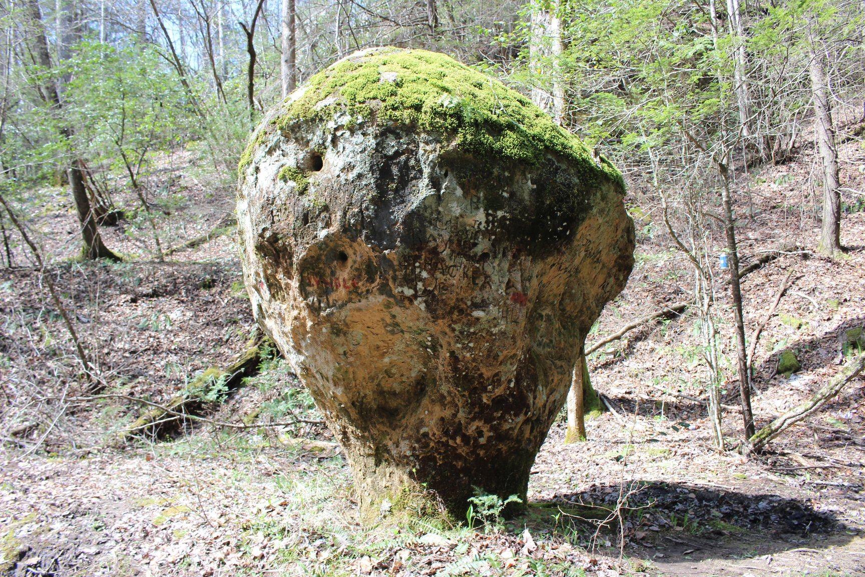
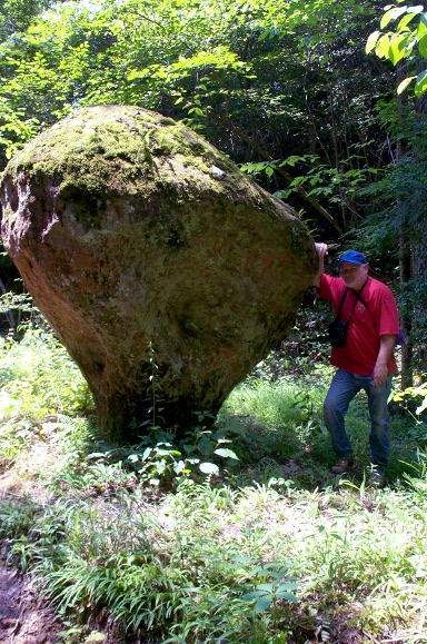
KY Bottle Rock 12'
Waypoint: KYR002 36.601458,-84.006590
County: KY landforms of KY county
popup list of
nearby landforms (mileage, bearing)
MAPS
Select one of the following maps to display this waypoint (WGS84).
GPS
Remarks:
Reference: Fife brothers
Tennessee landforms
home
arches
waterfalls
rocks
peaks
balds
sinks
lakes
regions
county
GSMNP landforms (TN/NC)
BSF landforms (TN/KY)
or nearby
lookout towers
Chuck Sutherland's www.tnlandforms.com the future (2024)
 ©
Tom Dunigan
©
Tom Dunigan