 There is also a small tunnel
| WGS84 | |
| 36.607579 | -84.853167 |
| 36° 36.455'N | 84° 51.19'W |
| 36° 36' 27.3"N | 84° 51' 11.4"W |
| 16S 692007E 4053487N | |
| convert to NAD27 | |
MAPS
Select one of the following maps to display this waypoint (WGS84).
GPS
Remarks:
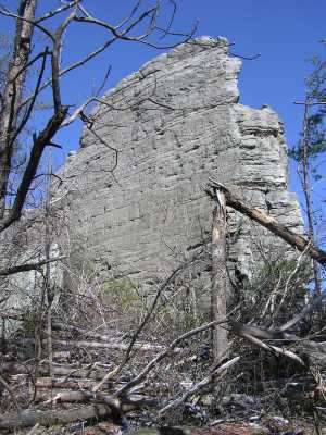
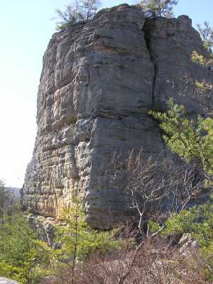
This massive chimney is in Kentucky, but a trail from Greenwood Cliff in Tennessee leads to the chimney.
There is also a small tunnel
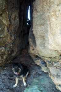 photo courtesy Keith Garnes
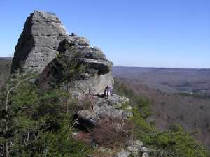
There are arches and tunnels in the Greenwood Cliff nature conservancy.