Tennessee Landforms -- waterfalls| WGS84 |
| 36.109300 | -83.974600 |
| 36° 6.558'N | 83° 58.476'W |
| 36° 6' 33.5"N | 83° 58' 28.6"W |
| 17S 232240E 4000170N |
| convert to NAD27 |
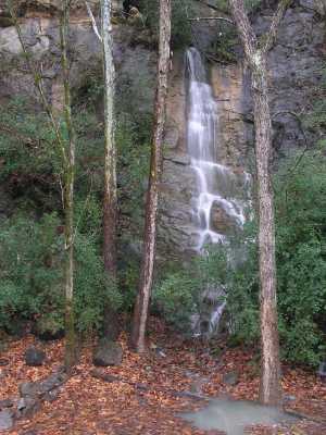
Quarry Falls 28'
Waypoint: KNF002 36.109300,-83.974600
County: Knox landforms of Knox county
Locale: private
popup list of
nearby landforms (mileage, bearing)
MAPS
Select one of the following maps to display this waypoint (WGS84).
GPS
Remarks:
wet-weather falls from an underground stream. Also a small
falls nearby just on the north side of Ellis Lane.
Tennessee landforms
home
arches
waterfalls
rocks
peaks
balds
sinks
lakes
regions
county
GSMNP landforms (TN/NC)
BSF landforms (TN/KY)
or nearby
lookout towers
Chuck Sutherland's www.tnlandforms.com the future (2024)
 ©
Tom Dunigan
©
Tom Dunigan