Tennessee Landforms -- arches and natural bridges| WGS84 |
| 35.957100 | -83.863500 |
| 35° 57.426'N | 83° 51.81'W |
| 35° 57' 25.6"N | 83° 51' 48.6"W |
| 17S 241746E 3982981N |
| convert to NAD27 |
Ijams Arch 9x10
Waypoint: KNA002 35.957100,-83.863500
County: Knox landforms of Knox county
Locale: Ijams
NABSQNO 17S-241746-3982981
popup list of
nearby landforms (mileage, bearing)
MAPS
Select one of the following maps to display this waypoint (WGS84).
GPS
Remarks:
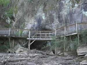
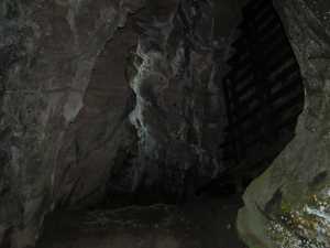
Reference: this is likely the "marble arch" referred to in Corgan & Parks #9 pg 95.
This partial arch with an
Ijams Nature Center boardwalk across its face
is cut out of the limestone bluff on the edge of the lake.
Tennessee landforms
home
arches
waterfalls
rocks
peaks
balds
sinks
lakes
regions
county
GSMNP landforms (TN/NC)
BSF landforms (TN/KY)
or nearby
lookout towers
Chuck Sutherland's www.tnlandforms.com the future (2024)
 ©
Tom Dunigan
©
Tom Dunigan