Tennessee Landforms -- waterfalls| WGS84 |
| 36.567500 | -81.705000 |
| 36° 34.05'N | 81° 42.3'W |
| 36° 34' 3"N | 81° 42' 18"W |
| 17S 436918E 4047127N |
| convert to NAD27 |
Gentry Creek Falls 40'
Waypoint: JOF001 36.567500,-81.705000
County: Johnson landforms of Johnson county
Locale: Cherokee National Forest
popup list of
nearby landforms (mileage, bearing)
MAPS
Select one of the following maps to display this waypoint (WGS84).
GPS
Remarks:
double falls on CNF trail 51, some history
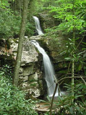
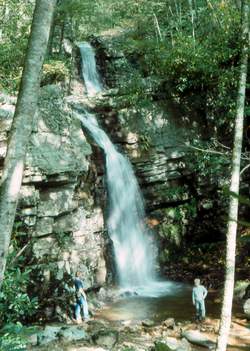 Photo by Gregory Plumb, Author of
Waterfalls of Tennessee
Photo by Gregory Plumb, Author of
Waterfalls of Tennessee
Bill Stowell reports more waterfalls upstream at
36.57086 -81.70278
Tennessee landforms
home
arches
waterfalls
rocks
peaks
balds
sinks
lakes
regions
county
GSMNP landforms (TN/NC)
BSF landforms (TN/KY)
or nearby
lookout towers
Chuck Sutherland's www.tnlandforms.com the future (2024)
 ©
Tom Dunigan
©
Tom Dunigan