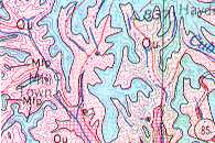
 no fault indications on TN geology map
| WGS84 | |
| 36.378610 | -85.780560 |
| 36° 22.717'N | 85° 46.834'W |
| 36° 22' 43"N | 85° 46' 50"W |
| 16S 609380E 4026634N | |
| convert to NAD27 | |
MAPS
Select one of the following maps to display this waypoint (WGS84).
GPS
Remarks:
Dycus disturbance article '06
no fault indications on TN geology map
TN craters (not visually significant): Howell Crater or Flynn Creek Crater or Wells Creek Crater or Dycus Crater