Tennessee Landforms -- arches and natural bridges| WGS84 |
| 36.485194 | -85.751861 |
| 36° 29.112'N | 85° 45.112'W |
| 36° 29' 6.7"N | 85° 45' 6.7"W |
| 16S 611801E 4038490N |
| convert to NAD27 |
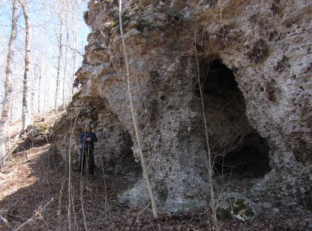
Crabtree Cr Arch 6x12
Waypoint: JAA002 36.485194,-85.751861
County: Jackson landforms of Jackson county
NABSQNO 16S-611801-4038490
popup list of
nearby landforms (mileage, bearing)
MAPS
Select one of the following maps to display this waypoint (WGS84).
GPS
Remarks:
Reference and photo:Kristen Bobo
 or hi-res
Tennessee landforms
home
arches
waterfalls
rocks
peaks
balds
sinks
lakes
regions
county
GSMNP landforms (TN/NC)
BSF landforms (TN/KY)
or nearby
lookout towers
Chuck Sutherland's www.tnlandforms.com the future (2024)
 ©
Tom Dunigan
©
Tom Dunigan