Tennessee Landforms -- waterfalls| WGS84 |
| 36.568440 | -83.018880 |
| 36° 34.106'N | 83° 1.133'W |
| 36° 34' 6.4"N | 83° 1' 8"W |
| 17S 319347E 4048896N |
| convert to NAD27 |
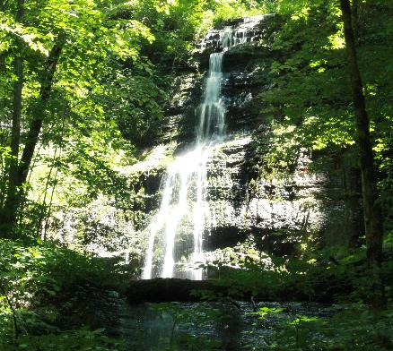
Kyles Ford Falls 25'
Waypoint: HNF011 36.568440,-83.018880
County: Hancock landforms of Hancock county
popup list of
nearby landforms (mileage, bearing)
MAPS
Select one of the following maps to display this waypoint (WGS84).
GPS
Remarks:
Reference and photo: Dana Koogler
trail map
Tennessee landforms
home
arches
waterfalls
rocks
peaks
balds
sinks
lakes
regions
county
GSMNP landforms (TN/NC)
BSF landforms (TN/KY)
or nearby
lookout towers
Chuck Sutherland's www.tnlandforms.com the future (2024)
 ©
Tom Dunigan
©
Tom Dunigan