Tennessee Landforms -- waterfalls| WGS84 |
| 36.468930 | -83.280230 |
| 36° 28.136'N | 83° 16.814'W |
| 36° 28' 8.2"N | 83° 16' 48.8"W |
| 17S 295696E 4038379N |
| convert to NAD27 |
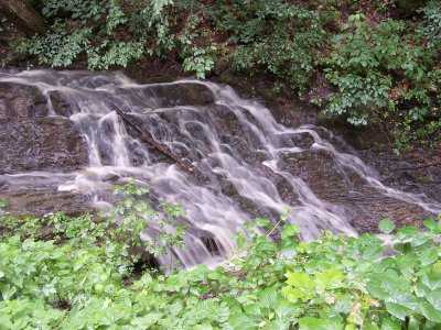
Matfield Falls 20'
Waypoint: HNF008 36.468930,-83.280230
County: Hancock landforms of Hancock county
Locale: private
popup list of
nearby landforms (mileage, bearing)
MAPS
Select one of the following maps to display this waypoint (WGS84).
GPS
Remarks:
Reference & photo: Robert Robbins
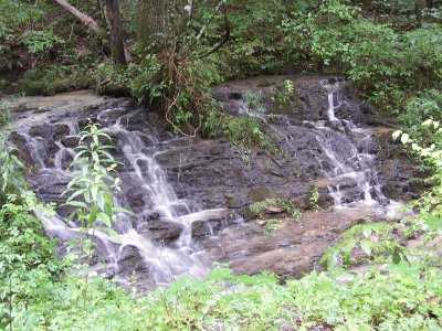
Sharon Blackstock reports lower Matfield Falls at
36.467722,-83.285037
and photo
Tennessee landforms
home
arches
waterfalls
rocks
peaks
balds
sinks
lakes
regions
county
GSMNP landforms (TN/NC)
BSF landforms (TN/KY)
or nearby
lookout towers
Chuck Sutherland's www.tnlandforms.com the future (2024)
 ©
Tom Dunigan
©
Tom Dunigan