Tennessee Landforms -- waterfalls| WGS84 |
| 36.520700 | -83.188400 |
| 36° 31.242'N | 83° 11.304'W |
| 36° 31' 14.5"N | 83° 11' 18.2"W |
| 17S 304055E 4043932N |
| convert to NAD27 |
Fall Branch Falls (2) 20'
Waypoint: HNF003 36.520700,-83.188400
County: Hancock landforms of Hancock county
Locale: private
popup list of
nearby landforms (mileage, bearing)
MAPS
Select one of the following maps to display this waypoint (WGS84).
GPS
Remarks:
Reference & photo: Robert Robbins
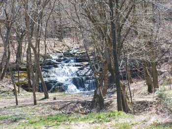 lower falls
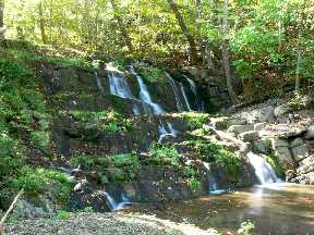 upper falls (Dave Aldrige photo)
Tennessee landforms
home
arches
waterfalls
rocks
peaks
balds
sinks
lakes
regions
county
GSMNP landforms (TN/NC)
BSF landforms (TN/KY)
or nearby
lookout towers
Chuck Sutherland's www.tnlandforms.com the future (2024)
 ©
Tom Dunigan
©
Tom Dunigan