Tennessee Landforms -- waterfalls| WGS84 |
| 36.433980 | -83.245350 |
| 36° 26.039'N | 83° 14.721'W |
| 36° 26' 2.3"N | 83° 14' 43.3"W |
| 17S 298731E 4034428N |
| convert to NAD27 |
Elrod Falls 50'
Waypoint: HNF001 36.433980,-83.245350
County: Hancock landforms of Hancock county
popup list of
nearby landforms (mileage, bearing)
MAPS
Select one of the following maps to display this waypoint (WGS84).
GPS
Remarks:
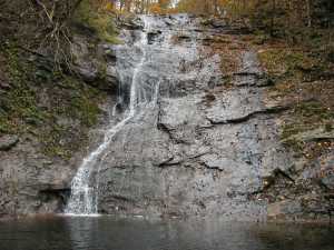
Lower Elrod
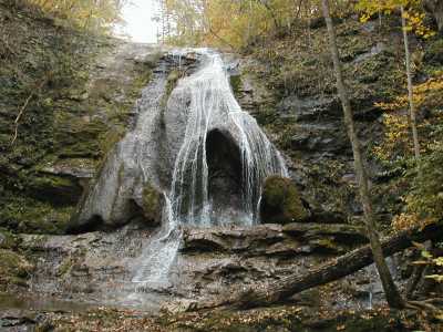
Upper Elrod
There is an additional cascade/slide above the upper falls.
Tennessee landforms
home
arches
waterfalls
rocks
peaks
balds
sinks
lakes
regions
county
GSMNP landforms (TN/NC)
BSF landforms (TN/KY)
or nearby
lookout towers
Chuck Sutherland's www.tnlandforms.com the future (2024)
 ©
Tom Dunigan
©
Tom Dunigan