Tennessee Landforms -- waterfalls| WGS84 |
| 35.264617 | -85.272564 |
| 35° 15.877'N | 85° 16.354'W |
| 35° 15' 52.6"N | 85° 16' 21.2"W |
| 16S 657130E 3903757N |
| convert to NAD27 |
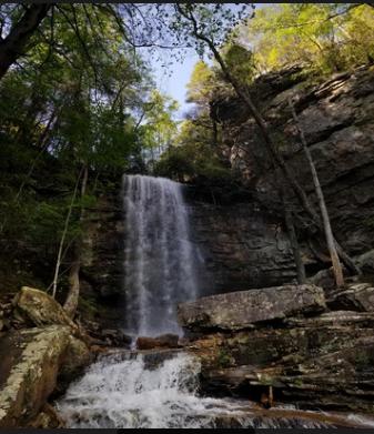
Panther Falls 52'
Waypoint: HMF039 35.264617,-85.272564
County: Hamilton landforms of Hamilton county
popup list of
nearby landforms (mileage, bearing)
MAPS
Select one of the following maps to display this waypoint (WGS84).
GPS
Remarks:
Reference and photo: Ryan Gardner
Tennessee landforms
home
arches
waterfalls
rocks
peaks
balds
sinks
lakes
regions
county
GSMNP landforms (TN/NC)
BSF landforms (TN/KY)
or nearby
lookout towers
Chuck Sutherland's www.tnlandforms.com the future (2024)
 ©
Tom Dunigan
©
Tom Dunigan