Tennessee Landforms -- waterfalls| WGS84 |
| 35.141790 | -85.385870 |
| 35° 8.507'N | 85° 23.152'W |
| 35° 8' 30.4"N | 85° 23' 9.1"W |
| 16S 647044E 3889960N |
| convert to NAD27 |
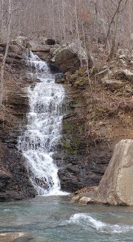
Trillium Falls 40'
Waypoint: HMF035 35.141790,-85.385870
County: Hamilton landforms of Hamilton county
popup list of
nearby landforms (mileage, bearing)
MAPS
Select one of the following maps to display this waypoint (WGS84).
GPS
Remarks:
Reference and photo: Christopher Lewis
another 30' falls upstream at
35.14228, -85.38415
Tennessee landforms
home
arches
waterfalls
rocks
peaks
balds
sinks
lakes
regions
county
GSMNP landforms (TN/NC)
BSF landforms (TN/KY)
or nearby
lookout towers
Chuck Sutherland's www.tnlandforms.com the future (2024)
 ©
Tom Dunigan
©
Tom Dunigan