Tennessee Landforms -- waterfalls| WGS84 |
| 35.191575 | -85.285076 |
| 35° 11.495'N | 85° 17.105'W |
| 35° 11' 29.7"N | 85° 17' 6.3"W |
| 16S 656132E 3895635N |
| convert to NAD27 |
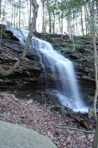
Flat Rock Falls 25'
Waypoint: HMF030 35.191575,-85.285076
County: Hamilton landforms of Hamilton county
popup list of
nearby landforms (mileage, bearing)
MAPS
Select one of the following maps to display this waypoint (WGS84).
GPS
Remarks:
Reference and photo: Steve Rogers
Tennessee landforms
home
arches
waterfalls
rocks
peaks
balds
sinks
lakes
regions
county
GSMNP landforms (TN/NC)
BSF landforms (TN/KY)
or nearby
lookout towers
Chuck Sutherland's www.tnlandforms.com the future (2024)
 ©
Tom Dunigan
©
Tom Dunigan