Tennessee Landforms -- waterfalls| WGS84 |
| 35.230600 | -85.238680 |
| 35° 13.836'N | 85° 14.321'W |
| 35° 13' 50.2"N | 85° 14' 19.3"W |
| 16S 660280E 3900038N |
| convert to NAD27 |
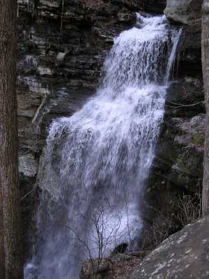
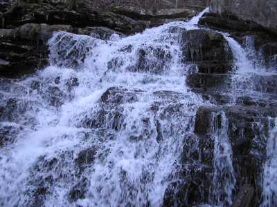
Clear Branch Falls 40'
Waypoint: HMF007 35.230600,-85.238680
County: Hamilton landforms of Hamilton county
Locale: PktWldns
popup list of
nearby landforms (mileage, bearing)
MAPS
Select one of the following maps to display this waypoint (WGS84).
GPS
Remarks:
off-trail.
Also see
the
North Chickamauga Creek Gorge,
and TN
natural area,
and pocket wilderness
Pics of lower falls and upper cascade.
Tennessee landforms
home
arches
waterfalls
rocks
peaks
balds
sinks
lakes
regions
county
GSMNP landforms (TN/NC)
BSF landforms (TN/KY)
or nearby
lookout towers
Chuck Sutherland's www.tnlandforms.com the future (2024)
 ©
Tom Dunigan
©
Tom Dunigan