Tennessee Landforms -- arches and natural bridges| WGS84 |
| 35.209600 | -85.277400 |
| 35° 12.576'N | 85° 16.644'W |
| 35° 12' 34.6"N | 85° 16' 38.6"W |
| 16S 656796E 3897647N |
| convert to NAD27 |
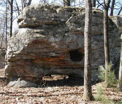
Needleseye 5x2
Waypoint: HMA011 35.209600,-85.277400
County: Hamilton landforms of Hamilton county
NABSQNO 16S-656796-3897647
popup list of
nearby landforms (mileage, bearing)
MAPS
Select one of the following maps to display this waypoint (WGS84).
GPS
Remarks:
References: C/P:15
Tennessee landforms
home
arches
waterfalls
rocks
peaks
balds
sinks
lakes
regions
county
GSMNP landforms (TN/NC)
BSF landforms (TN/KY)
or nearby
lookout towers
Chuck Sutherland's www.tnlandforms.com the future (2024)
 ©
Tom Dunigan
©
Tom Dunigan