Tennessee Landforms -- arches and natural bridges| WGS84 |
| 35.128935 | -85.364880 |
| 35° 7.736'N | 85° 21.893'W |
| 35° 7' 44.2"N | 85° 21' 53.6"W |
| 16S 648980E 3888565N |
| convert to NAD27 |
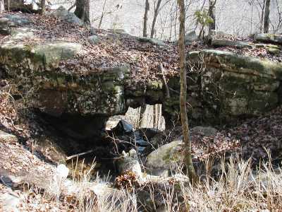
Lockhart Arch 6x5
Waypoint: HMA007 35.128935,-85.364880
County: Hamilton landforms of Hamilton county
Locale: Cumberland Trail
NABSQNO 16S-648980-3888565
popup list of
nearby landforms (mileage, bearing)
MAPS
Select one of the following maps to display this waypoint (WGS84).
GPS
Remarks:
References: JNAD:TENN-47,Russ Manning
Tennessee landforms
home
arches
waterfalls
rocks
peaks
balds
sinks
lakes
regions
county
GSMNP landforms (TN/NC)
BSF landforms (TN/KY)
or nearby
lookout towers
Chuck Sutherland's www.tnlandforms.com the future (2024)
 ©
Tom Dunigan
©
Tom Dunigan