Tennessee Landforms -- waterfalls| WGS84 |
| 35.442100 | -85.611640 |
| 35° 26.526'N | 85° 36.698'W |
| 35° 26' 31.6"N | 85° 36' 41.9"W |
| 16S 626009E 3922957N |
| convert to NAD27 |
Siphon Falls 25'
Waypoint: GUF033 35.442100,-85.611640
County: Grundy landforms of Grundy county
Locale: SavageGulf
popup list of
nearby landforms (mileage, bearing)
MAPS
Select one of the following maps to display this waypoint (WGS84).
GPS
Remarks:
Reference and photo: Caleb Griffin
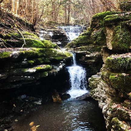 wet-weather cascade
Tennessee landforms
home
arches
waterfalls
rocks
peaks
balds
sinks
lakes
regions
county
GSMNP landforms (TN/NC)
BSF landforms (TN/KY)
or nearby
lookout towers
Chuck Sutherland's www.tnlandforms.com the future (2024)
 ©
Tom Dunigan
©
Tom Dunigan