Tennessee Landforms -- waterfalls| WGS84 |
| 35.241180 | -85.794280 |
| 35° 14.471'N | 85° 47.657'W |
| 35° 14' 28.3"N | 85° 47' 39.4"W |
| 16S 609703E 3900456N |
| convert to NAD27 |
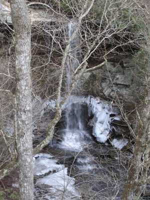
Monteagle Falls 40'
Waypoint: GUF013 35.241180,-85.794280
County: Grundy landforms of Grundy county
Locale: bvwp
popup list of
nearby landforms (mileage, bearing)
MAPS
Select one of the following maps to display this waypoint (WGS84).
GPS
Remarks:
private
Bridal Veil Wilderness Preserve
See pictures at
bridalveilbluffs.com
Tennessee landforms
home
arches
waterfalls
rocks
peaks
balds
sinks
lakes
regions
county
GSMNP landforms (TN/NC)
BSF landforms (TN/KY)
or nearby
lookout towers
Chuck Sutherland's www.tnlandforms.com the future (2024)
 ©
Tom Dunigan
©
Tom Dunigan