 Photo by Gregory Plumb, Author of
Waterfalls of Tennessee
Photo by Gregory Plumb, Author of
Waterfalls of Tennessee
| WGS84 | |
| 35.237500 | -85.786000 |
| 35° 14.25'N | 85° 47.16'W |
| 35° 14' 15"N | 85° 47' 9.6"W |
| 16S 610461E 3900057N | |
| convert to NAD27 | |
MAPS
Select one of the following maps to display this waypoint (WGS84).
GPS
Remarks:
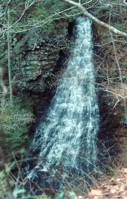
Photo by Gregory Plumb, Author of
Waterfalls of Tennessee
private Bridal Veil Wilderness Preserve See pictures at bridalveilbluffs.com