Tennessee Landforms -- arches and natural bridges| WGS84 |
| 35.220190 | -85.739270 |
| 35° 13.211'N | 85° 44.356'W |
| 35° 13' 12.7"N | 85° 44' 21.4"W |
| 16S 614738E 3898190N |
| convert to NAD27 |
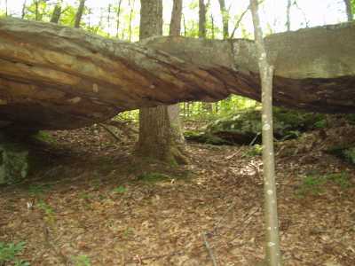
Raven Point Arch 21x6
Waypoint: GUA002 35.220190,-85.739270
County: Grundy landforms of Grundy county
Locale: trails
NABSQNO 16S-614738-3898190
popup list of
nearby landforms (mileage, bearing)
MAPS
Select one of the following maps to display this waypoint (WGS84).
GPS
Remarks:
References: JNAD:TENN-23, C/P:11
Gary Stephens photo
Tennessee landforms
home
arches
waterfalls
rocks
peaks
balds
sinks
lakes
regions
county
GSMNP landforms (TN/NC)
BSF landforms (TN/KY)
or nearby
lookout towers
Chuck Sutherland's www.tnlandforms.com the future (2024)
 ©
Tom Dunigan
©
Tom Dunigan