Tennessee Landforms -- waterfalls| WGS84 |
| 36.207000 | -83.556300 |
| 36° 12.42'N | 83° 33.378'W |
| 36° 12' 25.2"N | 83° 33' 22.7"W |
| 17S 270187E 4009938N |
| convert to NAD27 |
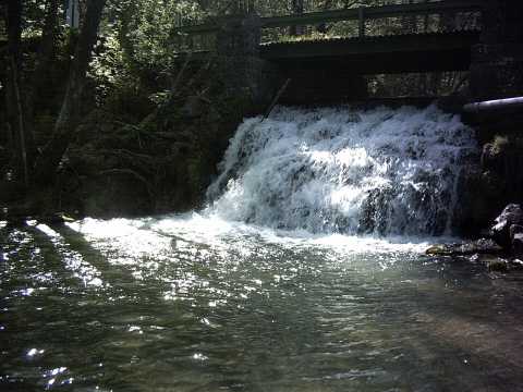
Buffalo Creek Falls 20'
Waypoint: GRF017 36.207000,-83.556300
County: Grainger landforms of Grainger county
Locale: WMA
popup list of
nearby landforms (mileage, bearing)
MAPS
Select one of the following maps to display this waypoint (WGS84).
GPS
Remarks:
Reference & photo: Kevin Baker
Below fish hatchery in WMA.
Tennessee landforms
home
arches
waterfalls
rocks
peaks
balds
sinks
lakes
regions
county
GSMNP landforms (TN/NC)
BSF landforms (TN/KY)
or nearby
lookout towers
Chuck Sutherland's www.tnlandforms.com the future (2024)
 ©
Tom Dunigan
©
Tom Dunigan