Tennessee Landforms -- waterfalls| WGS84 |
| 36.070220 | -82.649290 |
| 36° 4.213'N | 82° 38.957'W |
| 36° 4' 12.8"N | 82° 38' 57.4"W |
| 17S 351479E 3992996N |
| convert to NAD27 |
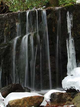
Sarvis Creek Cascades
Waypoint: GEF012 36.070220,-82.649290
County: Greene landforms of Greene county
Locale: Cherokee National Forest
popup list of
nearby landforms (mileage, bearing)
MAPS
Select one of the following maps to display this waypoint (WGS84).
GPS
Remarks:
A series of small falls and cascades upstream over the next half mile along
CNF trail 14.
 Marty Silver's photo
Tennessee landforms
home
arches
waterfalls
rocks
peaks
balds
sinks
lakes
regions
county
GSMNP landforms (TN/NC)
BSF landforms (TN/KY)
or nearby
lookout towers
Chuck Sutherland's www.tnlandforms.com the future (2024)
 ©
Tom Dunigan
©
Tom Dunigan