Tennessee Landforms -- waterfalls| WGS84 |
| 36.262600 | -82.777300 |
| 36° 15.756'N | 82° 46.638'W |
| 36° 15' 45.4"N | 82° 46' 38.3"W |
| 17S 340341E 4014540N |
| convert to NAD27 |
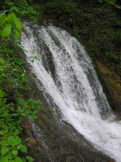
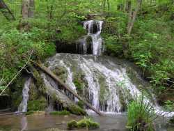
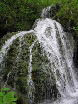
Babbs Mill Falls
Waypoint: GEF009 36.262600,-82.777300
County: Greene landforms of Greene county
Locale: private
popup list of
nearby landforms (mileage, bearing)
MAPS
Select one of the following maps to display this waypoint (WGS84).
GPS
Remarks:
Reference: Bill Stowell
Tennessee landforms
home
arches
waterfalls
rocks
peaks
balds
sinks
lakes
regions
county
GSMNP landforms (TN/NC)
BSF landforms (TN/KY)
or nearby
lookout towers
Chuck Sutherland's www.tnlandforms.com the future (2024)
 ©
Tom Dunigan
©
Tom Dunigan