Tennessee Landforms -- waterfalls| WGS84 |
| 35.962600 | -82.867800 |
| 35° 57.756'N | 82° 52.068'W |
| 35° 57' 45.4"N | 82° 52' 4.1"W |
| 17S 331571E 3981413N |
| convert to NAD27 |
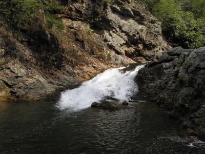
Dudley Falls 15'
Waypoint: GEF002 35.962600,-82.867800
County: Greene landforms of Greene county
Locale: Cherokee National Forest
popup list of
nearby landforms (mileage, bearing)
MAPS
Select one of the following maps to display this waypoint (WGS84).
GPS
Remarks:
Tennessee landforms
home
arches
waterfalls
rocks
peaks
balds
sinks
lakes
regions
county
GSMNP landforms (TN/NC)
BSF landforms (TN/KY)
or nearby
lookout towers
Chuck Sutherland's www.tnlandforms.com the future (2024)
 ©
Tom Dunigan
©
Tom Dunigan