Tennessee Landforms -- waterfalls| WGS84 |
| 35.080224 | -86.014480 |
| 35° 4.813'N | 86° 0.869'W |
| 35° 4' 48.8"N | 86° 0' 52.1"W |
| 16S 589844E 3882384N |
| convert to NAD27 |
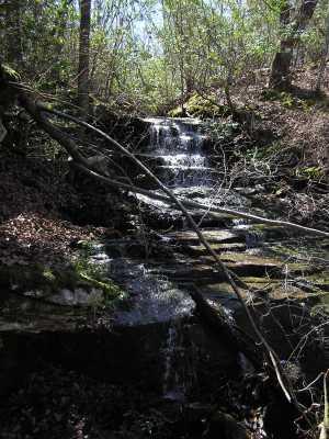
Cold Spring Cascade 15'
Waypoint: FRF015 35.080224,-86.014480
County: Franklin landforms of Franklin county
Locale: private
popup list of
nearby landforms (mileage, bearing)
MAPS
Select one of the following maps to display this waypoint (WGS84).
GPS
Remarks:
wet-weather cascade. off-trail
Tennessee landforms
home
arches
waterfalls
rocks
peaks
balds
sinks
lakes
regions
county
GSMNP landforms (TN/NC)
BSF landforms (TN/KY)
or nearby
lookout towers
Chuck Sutherland's www.tnlandforms.com the future (2024)
 ©
Tom Dunigan
©
Tom Dunigan