Tennessee Landforms -- waterfalls| WGS84 |
| 35.051300 | -86.015600 |
| 35° 3.078'N | 86° 0.936'W |
| 35° 3' 4.7"N | 86° 0' 56.2"W |
| 16S 589774E 3879175N |
| convert to NAD27 |
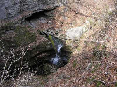
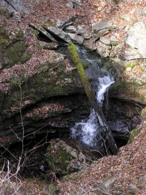
Wolf Cove Falls 15'
Waypoint: FRF013 35.051300,-86.015600
County: Franklin landforms of Franklin county
Locale: private
popup list of
nearby landforms (mileage, bearing)
MAPS
Select one of the following maps to display this waypoint (WGS84).
GPS
Remarks:
A stream exits a cave and tumbles into a sinkhole.
off-trail
Tennessee landforms
home
arches
waterfalls
rocks
peaks
balds
sinks
lakes
regions
county
GSMNP landforms (TN/NC)
BSF landforms (TN/KY)
or nearby
lookout towers
Chuck Sutherland's www.tnlandforms.com the future (2024)
 ©
Tom Dunigan
©
Tom Dunigan