Tennessee Landforms -- waterfalls| WGS84 |
| 35.050630 | -86.017780 |
| 35° 3.038'N | 86° 1.067'W |
| 35° 3' 2.3"N | 86° 1' 4"W |
| 16S 589575E 3879099N |
| convert to NAD27 |
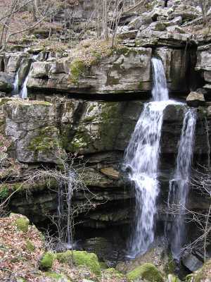
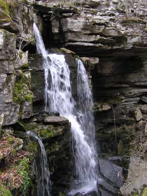
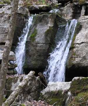
Split Falls 35'
Waypoint: FRF012 35.050630,-86.017780
County: Franklin landforms of Franklin county
Locale: private
popup list of
nearby landforms (mileage, bearing)
MAPS
Select one of the following maps to display this waypoint (WGS84).
GPS
Remarks:
A cascade splits into two falls and both disappear into sinkholes.
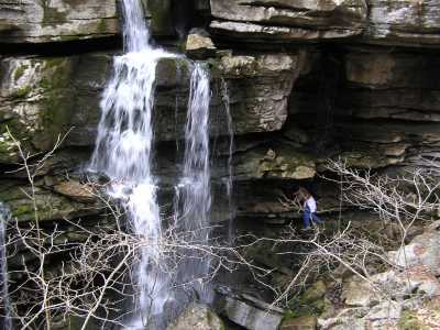
Observe the size of the humanoid in the second picture. off-trail.
Tennessee landforms
home
arches
waterfalls
rocks
peaks
balds
sinks
lakes
regions
county
GSMNP landforms (TN/NC)
BSF landforms (TN/KY)
or nearby
lookout towers
Chuck Sutherland's www.tnlandforms.com the future (2024)
 ©
Tom Dunigan
©
Tom Dunigan