Tennessee Landforms -- arches and natural bridges| WGS84 |
| 35.121100 | -85.909500 |
| 35° 7.266'N | 85° 54.57'W |
| 35° 7' 16"N | 85° 54' 34.2"W |
| 16S 599365E 3887017N |
| convert to NAD27 |
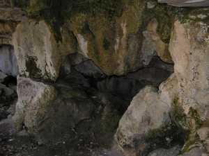
Peter Window 3x2
Waypoint: FRA007 35.121100,-85.909500
County: Franklin landforms of Franklin county
Locale: private
NABSQNO 16S-599365-3887017
popup list of
nearby landforms (mileage, bearing)
MAPS
Select one of the following maps to display this waypoint (WGS84).
GPS
Remarks:
Tennessee landforms
home
arches
waterfalls
rocks
peaks
balds
sinks
lakes
regions
county
GSMNP landforms (TN/NC)
BSF landforms (TN/KY)
or nearby
lookout towers
Chuck Sutherland's www.tnlandforms.com the future (2024)
 ©
Tom Dunigan
©
Tom Dunigan