Tennessee Landforms -- arches and natural bridges| WGS84 |
| 35.055800 | -86.000000 |
| 35° 3.348'N | 86° -0'W |
| 35° 3' 20.9"N | 86° -0' 0"W |
| 16S 591191E 3879688N |
| convert to NAD27 |
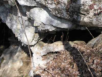
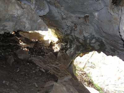
Sinking Cove Window 5x2
Waypoint: FRA004 35.055800,-86.000000
County: Franklin landforms of Franklin county
Locale: private
NABSQNO 16S-591191-3879688
popup list of
nearby landforms (mileage, bearing)
MAPS
Select one of the following maps to display this waypoint (WGS84).
GPS
Remarks:
This limestone window is part of the opening to a large cave. off-trail.
Tennessee landforms
home
arches
waterfalls
rocks
peaks
balds
sinks
lakes
regions
county
GSMNP landforms (TN/NC)
BSF landforms (TN/KY)
or nearby
lookout towers
Chuck Sutherland's www.tnlandforms.com the future (2024)
 ©
Tom Dunigan
©
Tom Dunigan