Tennessee Landforms -- rock formations| WGS84 |
| 36.541100 | -84.852400 |
| 36° 32.466'N | 84° 51.144'W |
| 36° 32' 28"N | 84° 51' 8.6"W |
| 16S 692240E 4046113N |
| convert to NAD27 |
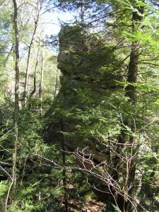
Phillip Chimney SE 30'
Waypoint: FER007 36.541100,-84.852400
County: Fentress landforms of Fentress county
Locale: PogueCreek
popup list of
nearby landforms (mileage, bearing)
MAPS
Select one of the following maps to display this waypoint (WGS84).
GPS
Remarks:
off-trail
Tennessee landforms
home
arches
waterfalls
rocks
peaks
balds
sinks
lakes
regions
county
GSMNP landforms (TN/NC)
BSF landforms (TN/KY)
or nearby
lookout towers
Chuck Sutherland's www.tnlandforms.com the future (2024)
 ©
Tom Dunigan
©
Tom Dunigan