Tennessee Landforms -- waterfalls| WGS84 |
| 36.351390 | -84.852500 |
| 36° 21.083'N | 84° 51.15'W |
| 36° 21' 5"N | 84° 51' 9"W |
| 16S 692700E 4025065N |
| convert to NAD27 |
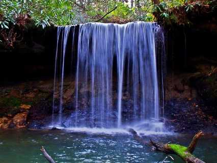
Bridal Veil Falls 10'
Waypoint: FEF018 36.351390,-84.852500
County: Fentress landforms of Fentress county
popup list of
nearby landforms (mileage, bearing)
MAPS
Select one of the following maps to display this waypoint (WGS84).
GPS
Remarks:
Reference and photo: Chris Oliver
Chris's newer photo 1 and
photo 2
Chris reports another falls downstream at
36.351228,-84.851914
Tennessee landforms
home
arches
waterfalls
rocks
peaks
balds
sinks
lakes
regions
county
GSMNP landforms (TN/NC)
BSF landforms (TN/KY)
or nearby
lookout towers
Chuck Sutherland's www.tnlandforms.com the future (2024)
 ©
Tom Dunigan
©
Tom Dunigan